Monday, March 21, 2005


The arch found along the North Fork of Taylor Creek in the Kolob Canyons section of Zion National Park

Friday, March 18, 2005

North Fork of Taylor Creek in Kolob Canyons of Zion Park

North Fork Taylor Creek


This was a nice hike but the highlight for us was spotting another arch. We seem to be into arches lately. This one is high on the cliff and can only be seen from certain angles. We were lucky to see it. We asked later at the visitor center and it was not named so we gave it a Brazilian name, Pico Rosado (pink spire) in honor of Bo's Brazilian wife. This hike is 7.5 miles (round trip) along an unmaintained route following the North Fork of Taylor Creek. The route begins at the Middle Fork of Taylor Creek Trail, which I had done before, but Bo had not. Take the middle fork to the first cabin and head to the left.

There is a fairly good path to take during the first section after the cabin, but then as it disappers just follow the stream bed to the end of the canyon.

Sunday, March 13, 2005


Zion Search and Rescue member Bo Beck and Kane County Search and Rescue Vice Commander standing on top of Jug Handle Arch in Zion National Park.

Friday, March 11, 2005

Jug Handle Arch

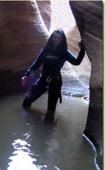
This was an enjoyable day with my friends Dean Kurtz and Bo Beck. We met in Zion, 2 miles east of the little tunnel. After a quick map reading lesson by Bo we started up the hill. Bo was going to have me use the map to find the arch today, but he cannot resist leading, which I like it that way! We started up the hill towards the entrance to the Keyhole Slot Canyon. The path was well used to the top of the saddle. Its a fairly steep hike all the way to the arch, so dont go expecting a leiusrly walk. The entire hike was only 1.2 miles one way, but it took about 2 hours. We stopped and talked and took a lot of photos along the way however.

At the top of the mesa it's a quick .2 miles over to the arch. The Jug Handle Arch is a propped arch, which hikers can actually walk right out on top of. Don't make the mistake I did and climb down the side to get a better photo. A huge rock went down the side with the slightest touch of my foot. The whole mountain side is unstable with all the rain we have been having. I was lucky to have been holding onto a tree. My search and rescue friends were not thrilled when they heard the rock fall and saw where I had snuck off to. They made a hand chain and held onto me just incase the tree decided to give way as well.

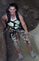
We decided to go back a different way. We hiked down to the ridge and went to the western side of that, around the top, then to the eastern side of the ridge. There we found nice pot holes of water which were visible when standing on top of the arch. Bo jumped into the water for his usual cold water dip. Fairly odd considering he wants no part of cold water canyoneering. We all got a kick out of Bo and took a couple of photos before heading to see the arch. Its actually a better view from down below the arch, but standing on top is always nice.

In the morning we are headed out to Kolob Canyons. The weather is suppose to be 70 degrees. Spring is comming quickly.

Spring is in the Air

I was getting my backpack ready for my weekly hike and throwing my winter and rain gear to the side felt so good. The only problem is that my pack is empty now. I am sure it was not that big at the start of the season! The coats, pants, socks, shoes and all the extra I have packed all winter have stretched my pack to enormous proportions. Soon the canyons will be acceptable for us warm weather canyoneers and the empty space will be filled with a harness, ropes, helmets and such. In the mean time I plan to enjoy my light weight pack for the day.

Saturday, March 05, 2005


Checkerboard Arch is a fun hike on the east side of Zion National Park. This is not a maintained route and gets little foot traffic.

Checkerboard Arch - Zion National Park

This last weekend we decided to go and find an arch near Checkerboard Mesa that my friend Gabriella spotted when hiked to Parunuweap. It was a cool February day and Zion has been having record amounts of precipitation. Even the start of the hike was gorgeous with water running in and through the many potholes. We started down the slot between Checkerboard Mesa and Quilt Mountain trying to avoid the muddy parts. We kept our feet pretty dry all the way to the arch. This is not a trail, but an unmaintained route crossing back and forth across the drainage. There is a nice view of Parunuweap in the distance from the saddle. To find the arch hike to the southern end of Checkerboard Mesa and then to the left. There is a path there and a few cairns. On a topo map look for 6273. This is the mountain the arch is on. It’s a large freestanding arch on the left side of the mountain. We took an alternate route back instead of retracing our steps. We were not sure if the slot would allow it, but we took our chances and we were lucky. This exit is only for hardcore hikers. Expect bushwhacking and an uphill hike until almost at the end then it’s a steep descent. The exit is 2 mile long like the approach was.


The water roars down into the lower Emerald Pool. Zion National Park has had rain and snow in abundance and its not letting up yet.