Tuesday, November 07, 2006

Water Canyon to Eagle Crags


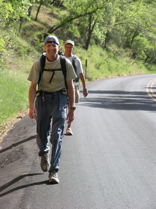
We set up a car shuttle with one car at Eagle Crags (Rockville near Zion) and the other at Hilldale (by Colorado City). We took the Smithsonian Butte Backway for the shuttle which is a great drive. We got underway about 9:30 am. Bo knew that Zion Rock was going to be there guiding a canyoneering trip, so we hiked up the steep trail to the head of Water Canyon (which we had to do anyway) to see where they start and asked about the rappels. Travis (who is on the Zion SAR team with Bo) said (I don't remember exactly) that there are about 8 rappels and 160' was the longest.

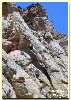
From there we hiked down the drainage until we found a good spot to climb up toward the hoodoos on top. We headed up the slickrock past lots of beautiful hoodoos. Then we got on the soft, sandy 4WD (that is suppose to be closed to 4WDs now) road and headed to the "Notch" and the "Windlass." Our directions we got from Bo's climbing friend Mikel told us to follow the dirt road and it would end at Sawmill Springs. There are lots of 4WD roads up there now – a mess of them. We followed a road and it got us way past the spring, so we had to dig out a map and figure out where the spring actually was since the roads were all over now. We got there and were happy to see there was water in the spring. Really gross water though! We set up camp and enjoyed the full moon and the food Bo cooked.

The night was COLD! Our water froze and there was ice on everything. We were warm in our bags though and we had those hot hand things to help us keep warm. We could not make a fire since we were in a wilderness study area.

The next day we started out — after the sun came up and it got warm. I was not leaving my sleeping bag before that!!! Bo was already up and cooked breakfast and hot drinks. (The perfect hiking partner!)

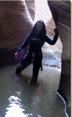
Sunday morning we headed down Sawmill Spring Wash. After hiking up hill all day on Saturday I was looking forward to some downhill. That area was perhaps the most spectacular of the whole hike. I will post some photos later today. We hiked the north edge to the 600' pour-off. Bo looked from the vantage point but could not see any weakness in the sheer cliff that might be the chute we were looking for. We hiked along the rim, looking at each weakness and for the cairn that Mikel had placed there. We had been told the exit was less than a mile from the vantage point and Bo dropped his pack and went quite a bit farther, still not finding it.

It was getting late and we had to make a choice — stay and look for the chute and maybe camp out (and have SAR called!) Or head back UPHILL to Water Canyon. ~groan~ I was looking forward to the downhill. As much as I hated to head back that's what we did. Bo decided to try and short cut so the parts that should have now been downhill were UPHILL. We were tired, but it was good exercise so we did not mind that much. We made it to the top of Water Canyon before dark and we saw the full moon peek over the mountain. We began to headlamp down the Water Canyon Trail, but we were dropping faster than the moon was rising so that was our only glimpse of it that night. So at least we did all the non-trail parts in daylight.

Canaan Mountain
Zion National Park

Friday, November 03, 2006

Zion National Park - Two Pines Arch


Two Pines Arch

Find a parking spot on the east side fo the Zion-Mt. Carmel Tunnel. Right now there is construction going on and it will continue until at least January 2006. There are some small parking area a little farther east of the tunnel that are actualy closer to the trailhead anyway. Located the beaten path a half mile east of the Canyon Overlook parking lot on the east side of the Zion-Mt. Carmel Tunnel.

The trailhead is on the north side of the road. Look for the small wash, identified by a yellow sign that says, "Caution Delays Possible Be Prepared to Stop". Cross over to the north side of the road and drop into the wash on the east side.

Once in the bottom of the wash, hike north for 150 yards. The wash splits into two. The prominent wash veers to the northwest and a less prominent wash goes to the right in a more northerly direction. Go right (north) and soon the wash will become more apparent. Hike in the wash. Soon a small, layered dryfall is encountered. Continue up the dryfall and the wash opens up. Look to the right at the base of the cliff where the "Two Pines Arch" can be seen. The arch is surrounded by ponderosa pine trees. At about .3 miles into the hike, the route leaves the easy terrain of the wash. Steer directly up the slickrock toward the arch. The climb is moderately steep, but it is only .1 mile.

Zion National Park

Two Pines Arch

Sunday, September 10, 2006

Zion National Park - Checkerboard Mesa


Today Bo and I headed to the top of Checkerboard Mesa. We had exited this way once last winter when the wash was snow filled. Bo had done the climbing route up Checkerboard Mesa before however and knew this route. We started about 10 and it was still shady on the side of the mountain we were hiking on. This made for a nice and easy trek up the mountainside. There are a couple of chimneys that you would have to hike around in the dirt, but besides that its a nice hike through the wash to the ledge where bushwacking is required to get to the top of Checkerboard Mesa.

Checkerboard Mesa
Zion National Park

Sunday, August 06, 2006

Zion National Park - Subway


The hike through the Left Fork of North Creek involves route finding, swimming ice cold pools and navigating through obstacles which often require the use of a rope. Today we took the kids! My 12 year old daughter and Bo's 20 year old son. This make the trip quite special. The kids laughed and spread their joy. We also invited a few other friends including Reid from the yahoo hiking group and his hiking buddy along with some of Bo's co-workers.

Sunday, July 02, 2006

Kolob Fire at Zion is 100% Contained

A few trails like the Subway are still closed but the fire is now 100% contained!

Friday, June 30, 2006

Kolob Fire - Zion National Park

The Kolob Fire is 80% contained and skies are cloudy and it looks like rain for the weekend. The main section of Zion National Park is open. Things are looking good and the fire should be contained by the time the weekend is over.

Tuesday, June 27, 2006

Zion National Park - Fire Update


A fire is burning near Virgin, Utah and the Kolob Terrace Road to a remote section of Zion National Park is closed. This photo is from a controlled burn in Zion a couple of years ago that was on the east side of the park. Currently avoid travel on the south side of Zion and visit the east side where the air is clear. Zion National Park itself is okay and the skies are clear.

Thursday, June 15, 2006

Zion National Park - East Temple Saddle


Hiking in Zion National Park - East Temple Mesa

Here is a route that is off the beaten path. The route begins at the well known Canyon Overlook Trail and runs through the saddle by Zion's East Temple and exits at Upper Pine Creek. Be prepared for slickrock scrambling since the start of this hike is rather steep and up the side of the mountain. The route is 2.25 miles long and once on top its a easy hike down, until hitting the slope going into Upper Pine Creek. At this point those sticky rubber shoes are crucial.

Trail Description
East Temple Route

Monday, May 08, 2006

Hiking across Zion National Park in one day!


By Bo Beck

First of all....the FFF was an idea that was inspired by my one time
supervisor, Terry Tucker. On a May day in the early 90's he sat down
and was studying the "Hiking Zion" book to get an idea what would be
a fun hike. Terry noted that many of the hikes were listed as better
spring hikes than they were summer hikes. Well since it was getting
close to summer and he had limited weekends to chose from , it would
be a good idea to hike all of the trails very soon.

His hike was done from Lee Pass to La Verkin Creek and up Willis
Creek to Kolob Reservoir then down West Rim and back up East Rim.
When I wanted to repeat the hike I decided I wanted to hike from East
to West and remain in the park the entire time, thus I did my first
crossing in 2001.

Since the scenery was so beautiful on that first hike, I decided that
I needed to hike west to east so it would be a new hike (Tanya has
taught me an appreciation of never doing the same hike over and over)
and thus yesterday became my second, however innaugural FFF!

We started with 6 cheery folks, but by Hop Valley TH we started sort
of splitting up and going our own paces. Got to admit though I stuck
with the one person that I thought I may be able to hang with the
whole time since he was 8 years my senior (age has nothing to do with
endurance by the way). Jeff....YOU DA MAN! Not only is Jeff a fun guy
to hike with, but has an uncanny sense of humor and has an eye like
an eagle. In all the years I've been hiking I would never have
noticed a DUCK...yes a DUCK perched in a Pine Tree on the Wildcat
Canyon Trail if it weren't for the keen eyes of Jeff! BTW...thanks
for letting me use your glasses in the hotel room so I could verify
that I had erased my trip log on the recorder!

Great Day, Great Friends........This is the Life! Thanks All!

Sunday, February 26, 2006

Zion National Park - Hidden Arch


Hidden Arch is a short little hike to a jug handle arch located on the east side of Zion National Park. Park your car at the Checkerboard Mesa parking lot. Look over the end of the wall for the beaten path. Its not a marked trail. Remember to stay on the path so the park does not close trails like this.

After you are in the creekbed, turn left. The water course will split. Take the fork on the right and hike up that for about 3/4 mile. Stay close to the mountainside. You can see the arch after you actually hike a bit past it.

Trail Information
Hidden Arch

Sunday, January 08, 2006

Zion National Park - Two Pines Arch


Two Pines Arch

Bo and I headed out to find one of the elusive natural arches in Zion National Park. We had heard about this arch and that it could actually be seen from the road. This is true, but it helps to hike there so you know were you a the road. Look for the slot or wash by the yellow road sign. Once down in the wash hike for about 150 yards. Hike in the wash to the arch.

Detailed directions and photos
Two Pine Arch