The trip is about 12 miles with a 2,000 ft. elevation gain. This is a route that few know of so it’s unlikely you will meet other hikers. The route goes through a wonderful slot canyon section, past a waterfall, over wind swept slick rock, past volcanic rock and white hoodoos, moqui marbles, sand and then climbs to the top of the mountain where white hoodoos are abundant. The route ends at a “V” in the cliffs above the Cannon Ranch where an old windlass is found.
To find the trailhead from Fredonia, Arizona, drive towards Hilldale on AZ389. Turn east on Utah Avenue at the Mark Twain Restaurant. Follow Utah Avenue for a couple of miles until it leaves the residential area and nears the high cliffs. There are two dirt roads to the east, take the second dirt road to the reservoir.
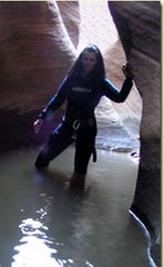
The route begins along a small stream just past the reservoir and climbs steeply along Water Canyon. About forty-five minutes into the hike you will reach a magnificent slot canyon section. This section can be explored or you can continue the trek up the mountain side. The path is well trodden in this area, but narrow so watch your step and don't take kids.
If you intend to hike past this point I suggest that you have mapped out the route on a topo map. Hiking past this point is only for experienced hikers and good map readers.
At the top of the mountain is a large rock, some trees and the point where you will begin to hike downhill, for a short while, before heading up hill again. Look for the large white hoodoo domes in the distance and head in that direction. The domes sit on a large section of wind swept slick rock that looks like a white Paria. At the far end of the domes is a magnificent view of Zion National Park. You will be able to see the Kolob section, the Eagle Crags as well as the east side of the park.
The next two miles of the hike are lacking significant elevation change, but they are across a deep sandy road that was used when motorized vehicles were allowed on the path. Follow the road to the first large “V” in the mountain. Below the “V” you will be able to see the town below as well as AZ389. To find the windlass continue hiking to the next large “V” in the mountain side. There are more hoodoos in this section and the path is again over a dirt road.
Look for the Canaan Ranch on your map. The “V” is directly above it. You will be able to see the remnants of the windlass as you approach. The windlass is a giant spool for steel cable that was used by the settlers to lower lumber down to the settlement below.
A Windlass:
A machine for raising weights, consisting of a horizontal
cylinder or roller moving on its axis, and turned by a
crank, lever, or similar means, so as to wind up a rope or
chain attached to the weight. In vessels the windlass is
often used instead of the capstan for raising the anchor.
It is usually set upon the forecastle, and is worked by
hand or steam.
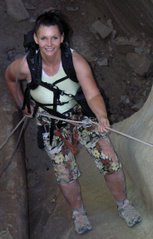
Thank you guys!
Zion National Park
Complete Trail Descriptions and Photo Album
Canaan Mountain and Water Canyon Hike
Zion National Park hiking guide