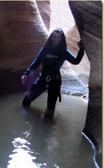
Concerning the actual SAR of the boy that fell 40 feet in the Left Fork that
was described in the article. We had a team of 7 that were flown over
to the west side of Russell Gulch and 2 of us were flown to the east
side fairly close to the entrance of the standard "Subway" route. A
line gun was fired from the west side and we retrieved the line on
the east side and established a "Highline". The west side operated
a "Tag Line" and the "Norweigian Reeve Hoist Line". The west side
also was in charge of "Track Line" tensioning. On the east side we
were only responsible for a high strength tie off of the "Track Line"
and operation of the east side "Tag Line". We also would
eventually "ferry" the Medic and Patient to our side for the
helicopter evac. Rick was the medic with the patient and had never
operated the prusiks and safety clip-in on a "Reeve" so I was chosen
to ride the litter down into Russell Gulch on the Reeve. Our side
only needed Tag Line Operation so only 1 person was necessary
initially on the east side. I was ferried out over Russell and
conducted the lower into the bottom of the canyon, helped package and
instructed Rick on Reeve Operation, then ran back up to the east side
station while the west side hoisted the Medic and Patient up to the
track line. Once clipped in to the carriage, our east side team of
two hauled them over and carried the litter to the heli-pad for evac
to DRMC. The operation went very smoothly and safely and took very
minimal time.
We could have used other means of extrication, but they would have
been much more timely, difficult and dangerous to the patient and
attendant. We have used "Highlines with Reeves" in numerous actual
situations and find them to be invaluable. The terrain in ZNP
dictates the system, but often times the Highline is the absolute
best!
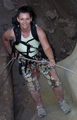
I have many photos showing Highlines (Sloping, Drooping, Single-
double-triple Track, Norwegian and English Reeves) Guiding Line and
Tag Line operations, standard raise and lowers, all configs of high
directionals, pickoffs- horizontal and vertical scoops, tilts, pike
and pivot exits, patient packaging, anchor systems, MA systems, etc
that I've accumulated over the last 11 years being involved with ZNP
SAR.
Originally when I got involved with SAR I assumed that you just went
down or up, got the patient and that was it! Since then I've learned
that there are many different "tools in the bag" available that make
High Angle Rescue safe and expedient.
Bo
Saturday, January 27, 2007
Wednesday, January 17, 2007
Getting Ready to Hike Across Zion in a Day - Again!
It was an early morning start on a Saturday, May 6th 2006. Plans had
been made over the preceding month or so and it was beginning to fit
together. I was to pick up Rob and Denise in Springdale somewhere
around 3AM, and then shuttle back to Kolob Canyons and meet the rest
of the group, Jeff, Steve and friend to begin at 4AM, a long day of
hiking.
This hike would travel through one of the most beautiful parks in the
National Park System and eventually culminate after roughly 50 miles
of walking. I had done this trip before some 5 years earlier, but had
started at the east entrance of Zion rather than the west side.
Steve and friend had driven up from Las Vegas the day before,
thinking that this would be a noble undertaking; Jeff on the other
hand had been on his annual dose of Zion and had thought that
seeing "Zion in a Day" would be a great fix! Rob....well....this
would be a "warm-up" for his 24 hour race in Southern Nevada next
weekend! Denise had spent many such outings that tested endurance,
stamina and will power, so this seemed to fit!
After our introductions and hello's at Lee Pass, the hiking began at
about 4:10. Headlamping as we descended, the group was pretty tight
knit all the way until we got to Hop Valley. Rob and I sort of broke
off to the front of the pack as twilight illuminated this magnificent
valley and we found ourselves stopping for some conversation and
reminiscing about some of the experiences we'd had in the past. Soon
the group formed again and we all converged at the Hop Valley
Trailhead where Steves lady friend and Robs lady friend had
refreshments and moral support. It was somewhere around 7AM or so. At
this point Rob had decided that he would be better off saving his
reserves for the race he had committed to next weekend. We started as
6, now down to 5. Steve and partner relaxed, took in some calories
and tended to feet while Denise and Jeff made a quick pit stop and
continued on the connector trail to Wildcat Canyon. I followed suit
shortly and caught Denise and Jeff somewhere around the Northgate
Peaks Trail. I was sure that Steve and partner would be shortly
behind. Denise, decided to stop and swap socks and told Jeff and I to
move along and she would follow. Arriving at the West Rim trail just
around 1 PM? a wonderful surprise! Tanya and Nikki awaited. What a
welcome sight after 25+ miles of walking. I hadn't expected to see
them until the Grotto! They had hiked from Lava Point with sandwiches
and drinks for us! Well, Jeff and I spent the next 30 minutes gorging
and enjoying the company and moral support these 2 wonderful ladies
offered, and soon the rest of the group had arrived. The miles had
begun to take their toll, as we knew they would. Realizing that it
was half over and that the next 14 miles would be downhill, Jeff and
I decided to get a start ahead of the rest. I told Tanya that we
should be at the Grotto somewhere around 4-4:30. Well....it was more
like 5-5:30, but there they were waiting, our support team! Thank
you! They asked us if we wanted to sit and rest before the long
ascent up the East Rim? I think both Jeff and I looked at each other
and without a word knew that if we sat now, we probably wouldn't (or
couldn't!) get up to finish. 39 miles down and 11 to go! We knew the
others couldn't be far behind and that support was waiting for them,
so off we went. Up the road (that shuttle sure was tempting!) and the
trudge up the East Rim. I think that knowing there were only 10 miles
left now made the ascent much easier, but I have to admit; the last
steep hill out of Echo Canyon was a BEAR! Even the gradual grade
beyond Stave Spring seemed like an eternity!
Ahhhhhhhhh....alas....the last 4 miles of gentle grade down was such
a relief! 2 miles before the end and here comes Tanya and Nikki!
Wow...such wonderful company and moral support this was. They offered
to carry our packs, but being proud, both Jeff and I declined their
generous offers. The next 2 miles were the best of the entire hike
with fun conversation and knowing that we were going to make the
entire 50 miles in one day. At 9:10 PM we arrived at Tanyas Van at
the East Entrance Of Zion national Park. We didn't learn that the
others had decided to end their respectable 39 mile journey at the
Grotto until later that evening. Jeff and I were ready for the 2 hour
shuttle back to our awaiting vehicles at Lee Pass, but Tanya so
kindly offered a motel room at her Best Western in Mt. Carmel
Junction. We were in heaven! I went out to the hot tub that evening
and low and behold out comes Steve and Crew! They had not found a
hotel room in Springdale as planned and also were staying at Tanyas
Best Western! After conversation and soothing soaking, I learned that
blisters and knee pounding had dampered their efforts to finish up
the remaining 11 miles. I have a feeling that Steve may want to give
this another go though. Denise also had previous arangements in
Springdale, so the Grotto was the logical stopping point for her as
well.
Well....The next morning, Tanya shuttled Jeff and I back to our
vehicles at Lee Pass and we said our farewells.
I just want to thank everyone for a fun adventure and all the support
given.
I sort of hope to be on the trail again this May if it is to be! If
there is anyone that would like to join, maybe we can give it another
go?
Cheers!
Bo
Sunday, January 07, 2007
Steamboat Rock - South Coyote Buttes

When we hiked to Cobra Arch - We saw Steamboat Rock from a distance and wondered --- so today we checked it out!
This place was cool! I just don't know how we could have been so lucky
to get out there when the sand was frozen ( driving and hiking made
simple) but the winter in this area RULES! After a day of hiking and
photographing that would make anyone drool I just have to say.....WoW!
You know what Tanya? Even the drive out, with my white knuckles as the
sand had softened, was so absorbed as I heard of Michael Kelsey’s
descriptions of the possible German, Russian Spies "Cache" at "Yellow
Rock" area, I really believe that one of these days we may too stumble
on to something inexplicable! ( I think we have) Wait!!!!!!! Its all
inexplicable! Where did it all come from? Rabbits lumbering in shaded
portals; Hawks perched on pillars a million years in the making...sand,
snow, wind and flows of mud uncovered after being hidden well before
history? Its an endless search that will always be welcome....at least
for those that desire.
Thank you again today for allowing me and driving me to continue that
search! I will never understand all the mysteries...thank goodness! How could it not be? Every thing just seemed like a painting, begging
to be seen. The posture of the Bunny was so straight, proud and un-
interrupted, it seemed as if he was just waiting to be admired. The
Redtail on top of the Dome perched motionless. I wanted to see its
eyes, but the distance was just a few feet too far. I still was able
to see his eyes, and I could see myself in them. I felt eerily like I
belonged there. Deja Vu?
The temps were perfect. The snow that had fallen several days
earlier had mostly melted except on the shaded slopes. The moisture
however had remained and was frozen on the surface and beneath. I
would guess that in the morning as we drove out 9AM, hovered around
25? and as we hiked maybe a couple deg. warmer. After
circumnavigating Steamboat Rock (shaded on the northern flanks) and
heading south back to the Rover, the sand had softened a little in
the sunlight. I was a bit worried that we may have to wait until the
night temps would freeze the ground once again, but mostly the
surface had thawed and the ground underneath remained frozen making
the drive back out perfect. All in all, I just don't know how it
could have been better.
Steamboat Rock would be better explored during hot/warm periods from
Buckskin Gulch at the Middle entrance/exit of the Gulch.
-- Bo Beck
Steamboat Rock
Zion National Park
Tuesday, November 07, 2006
Water Canyon to Eagle Crags

We set up a car shuttle with one car at Eagle Crags (Rockville near Zion) and the other at Hilldale (by Colorado City). We took the Smithsonian Butte Backway for the shuttle which is a great drive. We got underway about 9:30 am. Bo knew that Zion Rock was going to be there guiding a canyoneering trip, so we hiked up the steep trail to the head of Water Canyon (which we had to do anyway) to see where they start and asked about the rappels. Travis (who is on the Zion SAR team with Bo) said (I don't remember exactly) that there are about 8 rappels and 160' was the longest.
From there we hiked down the drainage until we found a good spot to climb up toward the hoodoos on top. We headed up the slickrock past lots of beautiful hoodoos. Then we got on the soft, sandy 4WD (that is suppose to be closed to 4WDs now) road and headed to the "Notch" and the "Windlass." Our directions we got from Bo's climbing friend Mikel told us to follow the dirt road and it would end at Sawmill Springs. There are lots of 4WD roads up there now – a mess of them. We followed a road and it got us way past the spring, so we had to dig out a map and figure out where the spring actually was since the roads were all over now. We got there and were happy to see there was water in the spring. Really gross water though! We set up camp and enjoyed the full moon and the food Bo cooked.
The night was COLD! Our water froze and there was ice on everything. We were warm in our bags though and we had those hot hand things to help us keep warm. We could not make a fire since we were in a wilderness study area.
The next day we started out — after the sun came up and it got warm. I was not leaving my sleeping bag before that!!! Bo was already up and cooked breakfast and hot drinks. (The perfect hiking partner!)
Sunday morning we headed down Sawmill Spring Wash. After hiking up hill all day on Saturday I was looking forward to some downhill. That area was perhaps the most spectacular of the whole hike. I will post some photos later today. We hiked the north edge to the 600' pour-off. Bo looked from the vantage point but could not see any weakness in the sheer cliff that might be the chute we were looking for. We hiked along the rim, looking at each weakness and for the cairn that Mikel had placed there. We had been told the exit was less than a mile from the vantage point and Bo dropped his pack and went quite a bit farther, still not finding it.
It was getting late and we had to make a choice — stay and look for the chute and maybe camp out (and have SAR called!) Or head back UPHILL to Water Canyon. ~groan~ I was looking forward to the downhill. As much as I hated to head back that's what we did. Bo decided to try and short cut so the parts that should have now been downhill were UPHILL. We were tired, but it was good exercise so we did not mind that much. We made it to the top of Water Canyon before dark and we saw the full moon peek over the mountain. We began to headlamp down the Water Canyon Trail, but we were dropping faster than the moon was rising so that was our only glimpse of it that night. So at least we did all the non-trail parts in daylight.
Canaan Mountain
Zion National Park
Friday, November 03, 2006
Zion National Park - Two Pines Arch

Two Pines Arch
Find a parking spot on the east side fo the Zion-Mt. Carmel Tunnel. Right now there is construction going on and it will continue until at least January 2006. There are some small parking area a little farther east of the tunnel that are actualy closer to the trailhead anyway. Located the beaten path a half mile east of the Canyon Overlook parking lot on the east side of the Zion-Mt. Carmel Tunnel.
The trailhead is on the north side of the road. Look for the small wash, identified by a yellow sign that says, "Caution Delays Possible Be Prepared to Stop". Cross over to the north side of the road and drop into the wash on the east side.
Once in the bottom of the wash, hike north for 150 yards. The wash splits into two. The prominent wash veers to the northwest and a less prominent wash goes to the right in a more northerly direction. Go right (north) and soon the wash will become more apparent. Hike in the wash. Soon a small, layered dryfall is encountered. Continue up the dryfall and the wash opens up. Look to the right at the base of the cliff where the "Two Pines Arch" can be seen. The arch is surrounded by ponderosa pine trees. At about .3 miles into the hike, the route leaves the easy terrain of the wash. Steer directly up the slickrock toward the arch. The climb is moderately steep, but it is only .1 mile.
Zion National Park
Two Pines Arch
Sunday, September 10, 2006
Zion National Park - Checkerboard Mesa

Today Bo and I headed to the top of Checkerboard Mesa. We had exited this way once last winter when the wash was snow filled. Bo had done the climbing route up Checkerboard Mesa before however and knew this route. We started about 10 and it was still shady on the side of the mountain we were hiking on. This made for a nice and easy trek up the mountainside. There are a couple of chimneys that you would have to hike around in the dirt, but besides that its a nice hike through the wash to the ledge where bushwacking is required to get to the top of Checkerboard Mesa.
Checkerboard Mesa
Zion National Park
Subscribe to:
Posts (Atom)